When the Mountain Closes In: How Geological Science Shapes Cave Rescue Operations
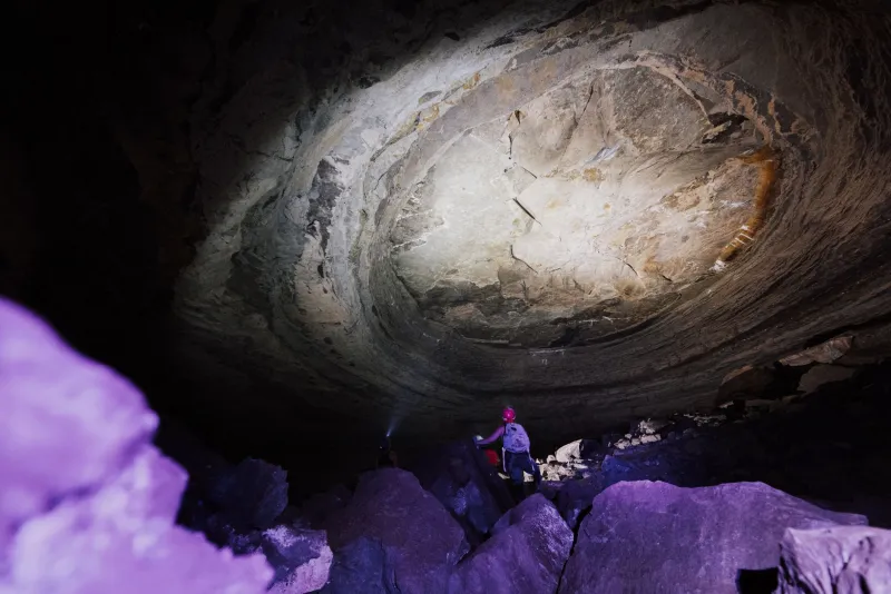
In the summer of 2014, a recreational caver exploring a passage in the Cumberland Plateau became disoriented after a sudden rise in water levels partially submerged a connecting corridor. What followed was a 22-hour rescue operation involving members of the National Cave Rescue Commission (NCRC), state emergency management personnel, and two consulting geologists who had mapped that specific karst system years earlier. The caver survived. According to rescue team members who participated in the operation, the geologists' intimate familiarity with the cave's drainage behavior was among the most decisive factors in the successful outcome.
That account is not unusual. Across the United States, from the limestone corridors of the Ozarks to the lava tube networks of the Pacific Northwest, cave rescue professionals have arrived at a consistent conclusion: geological knowledge is not supplementary to subterranean emergency response — it is foundational to it.
Reading the Rock Before the Emergency Begins
Cave rescue in the United States is coordinated primarily through the NCRC, a program operating under the auspices of the National Speleological Society. NCRC-trained teams operate in every major caving region of the country, and their curricula have evolved substantially over the past four decades to incorporate geological assessment as a core competency.
Rescue coordinators routinely emphasize that the first and most consequential decisions made during a cave emergency are geological ones. Before a single rescuer enters a passage, incident commanders must evaluate ceiling stability, assess the likelihood of hydrological changes, identify potential collapse zones, and determine whether the affected passage has characteristics that might trap additional personnel.
These assessments draw directly from speleological research. Detailed cave surveys, geomorphological studies, and hydrological monitoring data — the kind of scientific work produced by cave researchers and published through organizations like Speleos SIGA — form the informational backbone that rescue teams rely upon when conditions underground become critical.
"You cannot make good decisions in a cave rescue if you do not understand how that cave behaves," said one NCRC instructor who has participated in more than thirty subterranean rescue operations across the eastern United States. "The geology tells you where the water goes, where the ceiling is weak, where the air could become a problem. Every one of those factors can determine whether your rescue team comes back out."
Hydrology as Hazard: The Water Factor
Of all geological considerations in cave rescue, hydrology presents the most dynamic and frequently underestimated threat. Active cave systems — those with flowing water or direct connections to surface drainage — can experience rapid, dramatic changes in water level following precipitation events miles from the cave entrance.
The 2018 Tham Luang cave rescue in Thailand, which captured global attention, brought this reality into sharp relief for the general public. While that event occurred abroad, American cave rescue professionals were watching closely, noting that similar hydrological conditions exist in numerous karst systems throughout the Midwest and Appalachian regions.
In the United States, documented cases from caves in Missouri, Kentucky, and Tennessee illustrate how quickly a passable corridor can become a death trap following rainfall. In one well-documented Tennessee incident, a sump that rescue personnel had safely traversed during initial entry became impassable within four hours due to upstream precipitation. Teams with geologists on site had anticipated this possibility and staged their extraction accordingly. Teams without that expertise in similar past incidents have not always been so fortunate.
Hydrological mapping — the systematic documentation of how water moves through a cave system — is consequently treated as a priority resource in cave rescue planning. Jurisdictions with active caving communities have begun maintaining accessible databases of hydrological surveys for their local systems, a practice that rescue coordinators have advocated for years.
Morphology, Passage Geometry, and the Physics of Extraction
Beyond water, the physical geometry of a cave passage fundamentally constrains what rescue teams can accomplish. A caver with a broken pelvis requires a litter — a rigid evacuation stretcher — and litter passage through a cave demands meticulous assessment of every constriction, vertical pitch, and angular turn between the victim and the surface.
This is where detailed cave morphology becomes operationally critical. Rescue teams with access to accurate survey data can identify alternative routes, anticipate rigging challenges, and calculate whether a direct extraction path is viable or whether a longer but more accessible route must be used. In caves that have been thoroughly mapped and studied, this information is available before teams descend. In unmapped or poorly documented systems, rescuers must collect this data in real time, under pressure, while simultaneously managing a medical emergency.
Geological instability compounds these challenges significantly. In caves developed in mechanically weak rock — certain shales, heavily fractured limestones, or volcanic formations with irregular cooling patterns — ceiling falls represent a persistent hazard. Experienced cave rescuers learn to read the signs: fresh breakdown on the floor, tension cracks in ceiling rock, the distinctive sound of settling stone. This knowledge comes from speleological training and field experience, not from general emergency response curricula.
The Case for Pre-Event Scientific Investment
Perhaps the most consistent message from cave rescue professionals across the country is that the scientific work done before an emergency determines how effectively responders can manage it afterward. Caves that have been rigorously surveyed, hydrologically monitored, and geologically characterized present rescuers with a substantial operational advantage. Caves that have not been studied — and there are many throughout the American interior — represent scenarios where rescuers must reconstruct critical information under the worst possible conditions.
This reality has strengthened the relationship between cave science organizations and rescue networks. When researchers document a cave system's morphology, they are not merely contributing to geological knowledge. They are, potentially, producing the reference material that will guide a rescue team through a crisis years or decades in the future.
Some NCRC regions have formalized this relationship, partnering with local grottos and university research teams to ensure that survey data for frequently visited caves is current, accessible, and in a format that incident commanders can use rapidly. These partnerships represent a model that rescue professionals hope to see replicated nationally.
Training the Scientific Rescuer
Recognizing that geological literacy is inseparable from rescue competence, NCRC training programs have progressively expanded their earth science content. Trainees now receive instruction in basic karst geomorphology, sump behavior, rockfall assessment, and the interpretation of cave survey data. Advanced courses address hydrological dynamics and geological hazard identification in greater depth.
The integration of this content reflects a broader understanding within the cave rescue community: the underground environment does not accommodate generalist responders. Surface rescue techniques, however sophisticated, must be adapted to a geological context that is fundamentally unlike any above-ground scenario. The rock is not merely the setting for the emergency — it is an active participant in it, shaping every decision from the moment the alarm is raised to the moment the last rescuer returns to daylight.
For the cavers who venture into America's vast subterranean networks, that scientific commitment offers a measure of assurance. And for the researchers who dedicate careers to understanding how caves form, drain, and behave, it provides a reminder that the work of speleology carries consequences that extend well beyond academic publication.


