Crowdsourced Caves: How Amateur Explorers and Modern Technology Are Expanding America's Subterranean Map

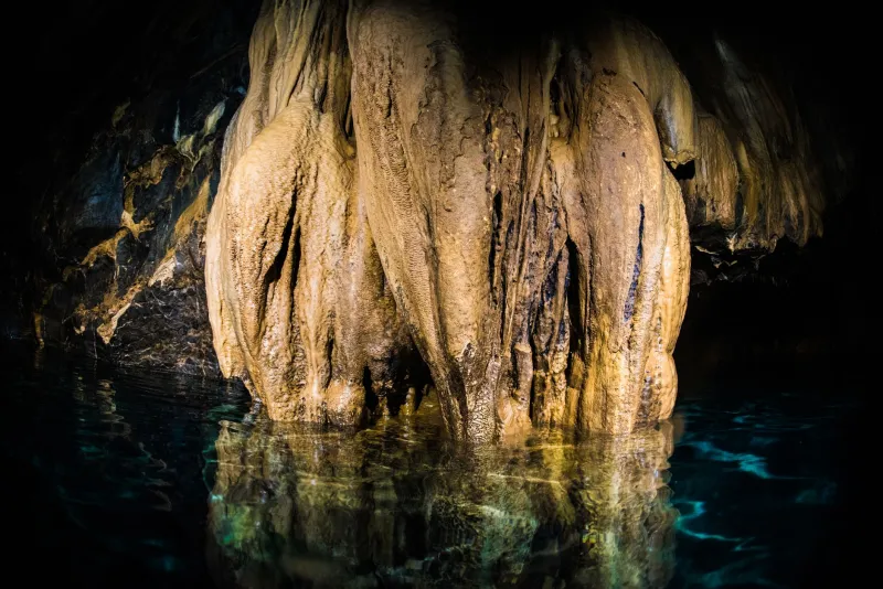
Photo by Photo by Yosuke Ota on Unsplash on Unsplash
For most of American history, documenting the nation's cave systems was a painstaking endeavor reserved for geologists, university research teams, and federal surveyors working with limited budgets and even more limited time. The result was an inventory that, while substantial, remained profoundly incomplete. Today, that picture is changing rapidly — and the agents of change are not always found in academic institutions. Increasingly, they carry headlamps, wear muddy kneepads, and submit their findings through smartphone applications.
The rise of citizen science in speleology represents one of the more remarkable shifts in how the United States catalogs its geological heritage. Tens of thousands of recreational cavers now participate in organized and informal documentation efforts, contributing survey data, photographic records, and geospatial coordinates to shared databases that feed directly into national research frameworks.
The Scale of What Remains Undiscovered
The United States is home to an estimated 45,000 known caves, yet researchers broadly agree that this figure represents only a fraction of what actually exists beneath the country's surface. Karst topography — the landscape type most conducive to cave formation — underlies roughly 20 percent of the continental United States, spanning regions from the Ozark Plateau and Appalachian highlands to the arid expanses of the Guadalupe Mountains in New Mexico and Texas.
Given this geographic breadth, systematic professional survey has never been feasible at the scale required. Federal agencies such as the National Park Service and the U.S. Forest Service maintain records for caves on public lands, but vast tracts of private property and remote wilderness remain effectively uncharted. It is precisely in these gaps that citizen scientists have begun to make their most consequential contributions.
Technology as the Great Equalizer
The tools now available to non-professional cavers would have been unimaginable to their predecessors even two decades ago. Consumer-grade GPS receivers provide location accuracy measured in centimeters rather than meters. Portable LiDAR — Light Detection and Ranging — scanners, once the exclusive province of well-funded research expeditions, have become sufficiently affordable that organized caving clubs can acquire and share them among members. These devices generate three-dimensional point-cloud maps of cave passages with extraordinary precision, producing data that rivals or exceeds what could previously be achieved only in formal survey campaigns.
Smartphone applications have proven equally transformative. Platforms developed in collaboration with speleological societies allow cavers to log passage dimensions, photograph formations, record biological observations, and geotag entrance coordinates — all within a standardized data structure that facilitates downstream analysis. Some applications incorporate offline functionality, a critical feature given that cellular connectivity is nonexistent underground and often sparse in the rural areas where significant cave discoveries tend to occur.
The National Speleological Society (NSS), headquartered in Huntsville, Alabama, has been instrumental in structuring these citizen contributions. Its affiliated grottos — local caving chapters distributed across all fifty states — serve as organizational nodes through which data collection is coordinated, quality-checked, and submitted to the NSS's cave database and, where appropriate, to state geological surveys.
Verification, Safety, and the Challenges of Open Participation
The democratization of cave documentation is not without its complications. Data quality remains a persistent concern. Survey measurements recorded by experienced cavers using calibrated instruments differ meaningfully from estimates made by novices with handheld compasses. Misidentified formations, inaccurate entrance coordinates, and incomplete passage surveys can introduce errors that are difficult to detect and correct once they propagate through shared databases.
Research institutions have responded by developing tiered verification systems. Submissions from cavers with documented training and survey experience are weighted differently than those from first-time contributors. Some regional programs assign professional liaisons who conduct field verification of high-priority reports — particularly those claiming discovery of previously unknown cave entrances or significant biological finds.
Safety presents a parallel challenge. Public enthusiasm for cave exploration has grown considerably in recent years, partly as a downstream effect of social media exposure. Not all who venture underground do so with adequate preparation. Rescue operations in cave environments are exceptionally resource-intensive, and incidents involving untrained explorers strain both emergency services and the goodwill of landowners whose cooperation is essential for continued research access. Organizations including the NSS and regional grottos invest substantially in education programs designed to raise baseline competency before participants engage in discovery-oriented fieldwork.
Institutional Partnerships and the Path Forward
Perhaps the most encouraging development in citizen speleology is the deepening of formal partnerships between amateur organizations and professional research bodies. Universities in cave-rich states such as Kentucky, Missouri, and Virginia have established structured volunteer programs through which trained citizen cavers assist with ongoing studies — collecting water samples, deploying biological monitoring equipment, and conducting repeat surveys to track passage changes over time.
The Cave Research Foundation, a nonprofit organization with a long history of scientific work in Mammoth Cave National Park and other significant systems, has expanded its volunteer science programs to explicitly incorporate citizen data collection within methodologically rigorous frameworks. Participants receive standardized training, use calibrated equipment, and submit data through protocols designed to meet peer-review standards.
Federal land managers have similarly recognized the value of structured citizen engagement. The Bureau of Land Management and the U.S. Forest Service have developed formal agreements with caving organizations in several western states, enabling volunteers to conduct preliminary surveys in areas where staffing constraints would otherwise prevent any systematic documentation.
What the Expanding Inventory Means for Science
Every newly documented cave is more than a cartographic addition. Each system represents a potential repository of biological, geological, hydrological, and climatological data. Cave-adapted species — many found nowhere else on Earth — may inhabit passages that have never been formally examined. Aquifer connections that influence water supplies for surface communities may be mapped for the first time. Speleothem formations that serve as paleoclimate archives may be identified and flagged for future research.
The cumulative effect of citizen-contributed data is already measurable. State cave inventories in Missouri, Tennessee, and West Virginia have grown by double-digit percentages over the past decade, with volunteer-reported discoveries accounting for a significant share of that growth. Researchers who might otherwise spend their limited field seasons conducting primary discovery work can instead focus analytical resources on systems that citizen cavers have already located and preliminarily characterized.
The subterranean United States remains, in the most literal sense, incompletely known. But the trajectory of citizen science in speleology suggests that the pace of discovery is accelerating — and that the partnership between enthusiastic amateur explorers and rigorous scientific institutions may ultimately prove more productive than either could achieve independently.