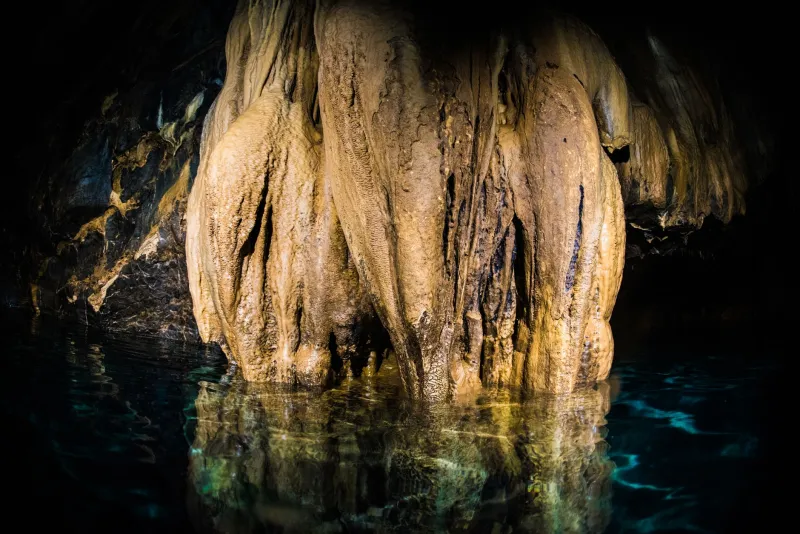
Stone Witnesses: Reading Hundreds of Thousands of Years of American Climate History Inside Cave Formations

Photo by Photo by Sergi Ferrete on Unsplash on Unsplash
Deep within the limestone caverns of the Appalachians, the Black Hills, and the Colorado Plateau, time accumulates in silence. Droplets of water percolate through the rock above, carrying dissolved minerals downward until they reach an open chamber and surrender their cargo, atom by atom, to the surface of a growing stalagmite. Each layer deposited in this process is a record — a chemical signature of the atmospheric and hydrological conditions that prevailed at the surface when that particular droplet fell as rain or snow, perhaps decades earlier.
Scientists who study these formations have a term for them: speleothems. And over the past three decades, the analysis of speleothems has emerged as one of the most powerful tools available to paleoclimatologists seeking to reconstruct Earth's climate history before the era of instrumental measurement.
Why Caves Make Exceptional Archives
The value of speleothems as climate proxies stems from several properties that distinguish them from other geological archives such as ice cores or sediment records. Cave environments maintain remarkably stable temperatures and humidity levels, conditions that favor the preservation of delicate chemical signals over geological timescales. Unlike ice cores, which are largely confined to polar regions and high-altitude glaciers, speleothems are found on every continent and across a broad range of latitudes and elevations — including throughout the continental United States.
Critically, speleothems can be dated with exceptional precision using uranium-thorium (U-Th) radiometric techniques. Uranium, dissolved in the groundwater that feeds cave drip sites, is incorporated into calcite as speleothems grow. Thorium, by contrast, is essentially absent from the initial deposit. Over time, uranium decays into thorium at a known rate, and the ratio of these isotopes within a given layer provides an age determination accurate to within decades for samples hundreds of thousands of years old — a level of chronological resolution that many other paleoclimate archives cannot match.
The Chemistry of Ancient Weather
The primary climate signal encoded in speleothems resides in the ratio of oxygen isotopes — specifically, oxygen-18 relative to the more common oxygen-16 — preserved within the calcite crystal structure. This ratio, denoted δ¹⁸O, reflects conditions in the atmosphere and hydrosphere at the time precipitation formed. Colder temperatures and shifts in moisture source regions alter the isotopic composition of rainfall and snowmelt in predictable ways, and those alterations are faithfully recorded in the speleothem layers deposited by water carrying that precipitation signal underground.
In practice, interpreting δ¹⁸O records requires careful calibration against modern instrumental data and a nuanced understanding of regional hydrology. A speleothem from a cave in the Ozark Plateau of Missouri will encode a somewhat different set of climate signals than one from a cave in Oregon or Florida, reflecting the distinct atmospheric dynamics governing precipitation in each region. Researchers must account for these regional signatures before drawing broader paleoclimate inferences.
Beyond oxygen isotopes, speleothems preserve additional proxies. Magnesium-to-calcium ratios respond to changes in the degree of prior calcite precipitation within the aquifer above the cave — itself a function of how long water resides in the rock before dripping, which correlates with surface moisture conditions. Carbon isotope ratios (δ¹³C) carry information about vegetation type and density above the cave, providing a complementary record of ecological conditions through time. Trace element concentrations, growth rate variations visible in annual laminae, and even the physical texture of calcite layers contribute to a multi-proxy picture that researchers can triangulate against one another.
What American Caves Have Already Revealed
Studies of speleothems from caves across the United States have produced findings that significantly refine our understanding of North American climate history. Research conducted on formations from Wind Cave and Jewel Cave in the Black Hills of South Dakota has documented the timing and magnitude of hydroclimate shifts during the last glacial maximum and the subsequent deglaciation period, revealing that moisture availability in the Great Plains changed on timescales considerably faster than previously appreciated.
In the southeastern United States, speleothem records from caves in Virginia and West Virginia have captured the signature of abrupt climate events — including the Younger Dryas cold reversal approximately 12,900 years ago — with a fidelity that complements and extends ice core records from Greenland. These findings help researchers understand how rapidly changing climate boundary conditions propagated through mid-latitude atmospheric systems.
Perhaps most striking are results from caves in the arid Southwest. Speleothems recovered from caves in New Mexico — including systems within the Guadalupe Mountains region — have recorded episodes of dramatically increased moisture during periods when orbital forcing drove the North American monsoon system into configurations quite unlike those of the present day. These records document intervals when portions of the modern American desert received precipitation volumes that would be extraordinary by contemporary standards, offering a sobering illustration of the range of natural climate variability that North American landscapes have experienced.
Connecting Ancient Records to Contemporary Climate Science
The relevance of speleothem-based paleoclimate research extends well beyond academic interest in geological history. Climate models used to project future conditions depend critically on their ability to reproduce past climate states. When modelers can compare their simulations against high-resolution, precisely dated proxy records from geographically distributed cave systems, they gain the ability to identify systematic biases and refine the physical parameterizations that govern model behavior.
Speleothem records have proven particularly valuable for testing model representations of the hydrological cycle — precipitation patterns, evapotranspiration rates, and soil moisture dynamics — which remain among the most uncertain components of current climate projections. The long temporal windows captured by cave formations, often extending through multiple glacial-interglacial cycles, provide test cases that span a far wider range of climate states than the instrumental record alone could supply.
Researchers at institutions including the University of New Mexico's Earth and Planetary Sciences department and the Desert Research Institute in Nevada have been at the forefront of integrating American speleothem records into model validation efforts, publishing findings that have materially influenced how the scientific community characterizes drought risk and precipitation variability across the western United States.
Preservation and the Limits of the Archive
For all their durability, speleothems are not indestructible archives. Physical disturbance — whether from seismic activity, flooding, or human visitation — can damage or destroy formations before their records are extracted. The introduction of artificial light sources into caves alters temperature and humidity in ways that affect active drip sites. Even the oils transferred from a human hand touching a stalagmite can contaminate the geochemical signal at that contact point.
These vulnerabilities underscore why cave conservation is inseparable from cave science. Protecting the geological integrity of cave environments is not merely an aesthetic or ecological concern — it is a prerequisite for preserving the climate data that those environments contain. As paleoclimatologists continue to refine their analytical methods and expand the geographic coverage of the American speleothem record, the caves themselves must remain intact, undisturbed, and accessible to the researchers who depend on them.
In this sense, every well-preserved stalagmite is both a scientific instrument and an irreplaceable document — a stone witness to climates that no human being ever observed, but that science is only now learning to read.