Building Above the Void: How Speleological Science Is Transforming Urban Development in America's Karst Landscapes
On the surface, Nashville, Tennessee, looks like any other rapidly expanding American city — cranes punctuating the skyline, new residential developments pushing outward into formerly rural corridors, and infrastructure struggling to keep pace with population growth. Beneath that surface, however, lies a different story entirely: an intricate lattice of limestone passages, dissolution cavities, and karst conduits that has, on more than one occasion, complicated or outright derailed construction projects. Nashville is not alone. From San Antonio, Texas, to Bowling Green, Kentucky, to the suburbs of St. Louis, Missouri, a significant portion of American urban expansion is occurring directly above cave systems of varying scale and complexity. The consequences of ignoring this geological reality have proven costly — and sometimes catastrophic.
The Karst Predicament
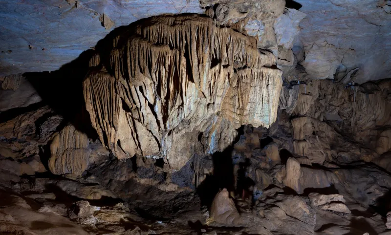
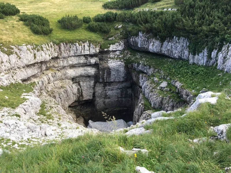
Karst terrain — characterized by soluble bedrock, typically limestone or dolomite, that has been sculpted over millennia by slightly acidic groundwater — underlies roughly 20 percent of the contiguous United States. These landscapes are defined by their permeability and instability. Water moves through them rapidly, carving passages that can range from microscopic fissures to cathedral-scale chambers. The same processes that produce the spectacular cave formations celebrated by speleologists also generate sinkholes, subsidence zones, and unpredictable voids that present genuine hazards to surface infrastructure.
For much of the twentieth century, urban development in karst regions proceeded with limited geological scrutiny. Engineers drilled boreholes, assessed load-bearing capacity at specific points, and proceeded with construction — often without any systematic effort to characterize the broader subsurface environment. The results were sometimes disastrous. Sinkholes have swallowed parking lots, undermined building foundations, and ruptured utility lines in cities across the karst belt. Insurance claims, litigation, and remediation costs have run into the hundreds of millions of dollars nationally.
The discipline of speleology — the scientific study of caves and karst systems — has emerged as an indispensable corrective to this pattern of geological neglect.
From Cave Survey to Construction Blueprint
Modern speleological engagement with urban planning begins well before a single foundation is poured. Cave researchers and karst hydrologists are now routinely retained during the earliest phases of site assessment, tasked with characterizing subsurface conditions through a combination of traditional cave survey techniques and advanced geophysical methods.
Ground-penetrating radar, electrical resistivity tomography, and microgravity surveys allow scientists to detect voids and zones of weak or dissolved rock without invasive excavation. These tools, refined largely through their application in cave research contexts, translate directly into the urban planning environment. When combined with detailed analysis of existing cave maps, spring locations, and historical sinkhole records, they provide planners with a far more nuanced picture of subsurface risk than conventional geotechnical assessment alone can offer.
In San Antonio — a city whose growth corridor sits squarely atop the Edwards Aquifer and its associated karst network — municipal authorities have developed formal protocols requiring karst assessments for development projects in designated sensitive zones. Speleologists and hydrologists contribute directly to these reviews, evaluating not only structural risk but also the potential for construction activities to alter groundwater flow paths or introduce contaminants into cave-connected aquifer systems.
Case Study: Bowling Green and the Mammoth Cave Corridor
Few American cities illustrate the complexities of karst urban development more vividly than Bowling Green, Kentucky. Located in Warren County, the city sits within the broader karst landscape associated with the Mammoth Cave system — the longest known cave system on Earth. Urban expansion in and around Bowling Green has repeatedly intersected with active karst processes, producing sinkholes in subdivisions, complications for road construction, and ongoing challenges for stormwater management.
Local authorities have responded by integrating speleological expertise into their planning apparatus in substantive ways. Cave researchers affiliated with Western Kentucky University and regional caving organizations have collaborated with city engineers to develop sinkhole risk maps that inform zoning decisions and construction setback requirements. Dye-tracing studies — a foundational technique in karst hydrology in which non-toxic fluorescent tracers are introduced into the groundwater system to map flow connections — have revealed that stormwater runoff from developed areas reaches cave passages within hours, underscoring the ecological stakes of surface land use decisions.
The lesson Bowling Green has absorbed, and is still in the process of institutionalizing, is that urban development above cave systems is not inherently impermissible — but it demands a level of geological literacy and interdisciplinary collaboration that conventional planning frameworks were never designed to provide.
Engineering Responses and Protective Protocols
Where development does proceed in karst-sensitive areas, speleological science informs a range of engineering interventions. Grouting programs — in which cementitious or polyurethane materials are injected into subsurface voids — can stabilize dissolution cavities beneath proposed structures, though their application requires detailed knowledge of void geometry that only thorough cave investigation can provide. Foundation designs are frequently adapted to span potential subsurface instabilities rather than resting on them, a strategy that depends entirely on accurate subsurface mapping.
Equally important are the protocols developed to protect cave ecosystems during and after construction. Karst systems support some of the most biologically distinctive communities in North America — communities that are exquisitely sensitive to changes in water chemistry, temperature, and sediment load. Speleobiologists working alongside civil engineers have helped establish construction-phase best management practices that limit sedimentation and chemical runoff into karst drainage networks, protecting cave fauna — including numerous federally listed threatened and endangered species — from the collateral damage of surface development.
A Discipline Finding Its Place at the Planning Table
The integration of speleological science into urban planning is still uneven across the United States. Some municipalities in high-risk karst zones have developed sophisticated, science-informed regulatory frameworks. Others continue to rely on minimal geotechnical assessment, leaving both infrastructure and underground ecosystems vulnerable.
Advocates within the speleological community argue that federal guidance — potentially through the U.S. Geological Survey or the Federal Emergency Management Agency's hazard mitigation programs — could help standardize karst assessment requirements nationwide, reducing the inconsistency that currently characterizes the field. The economic argument is compelling: the cost of rigorous pre-development cave assessment is a fraction of the cost of post-construction sinkhole remediation or structural failure.
There is also a values dimension that cave researchers are increasingly willing to articulate in public forums. The cave systems beneath American cities are not merely engineering obstacles. They are ecosystems of extraordinary biological significance, archives of geological and climatic history, and components of the freshwater infrastructure upon which communities depend. Urban planning that treats them as inconveniences to be engineered around — rather than systems to be understood and respected — does so at considerable long-term cost.
Toward a Geology-Literate Urbanism
The cities that are navigating karst development most successfully share a common characteristic: they have made a sustained institutional commitment to understanding what lies beneath them. That commitment is expressed in dedicated staffing, meaningful regulatory requirements, and genuine partnerships between municipal authorities and the scientific community — including the speleologists who have spent careers learning to read the language of caves.
America's karst landscapes are not going to stop growing. The cave systems beneath them are not going to become less complex. The question facing urban planners, developers, and elected officials across the karst belt is whether they will build the scientific literacy and institutional capacity necessary to develop responsibly above the void — or whether they will continue to discover, expensively and sometimes dangerously, what the ground beneath their cities has been trying to tell them all along.