The Ground Gives Way: How Cave Collapses Illuminate the Forces Shaping America's Subsurface
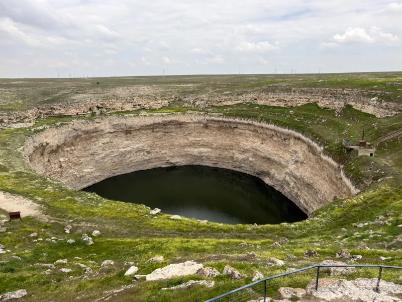
On a quiet morning in February 2014, a section of the National Corvette Museum in Bowling Green, Kentucky, disappeared. A sinkhole roughly 40 feet wide and 25 feet deep opened beneath the Skydome exhibit hall, swallowing eight rare automobiles. The event drew national media attention, but for speleologists, the spectacle masked a more consequential story: the collapse was a visible expression of processes that had been unfolding silently for thousands of years beneath the Mammoth Cave region's karst landscape.
Cave collapses and sinkholes are among the most dramatic surface manifestations of underground geology. Yet their significance extends well beyond property damage or human hazard. To researchers who study cave systems, these failures represent a form of subsurface communication — one that, when properly interpreted, can illuminate tectonic stress, groundwater dynamics, and the long-term structural evolution of entire geological regions.
The Architecture of Failure
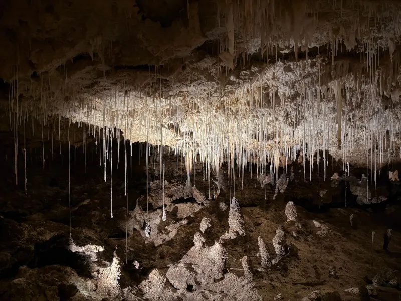
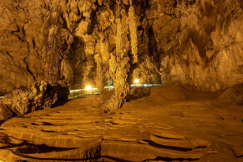
Understanding why caves collapse requires appreciating how they form in the first place. The majority of American cave systems develop within soluble rock — primarily limestone and dolomite — through a process called karstification. Mildly acidic groundwater, carrying dissolved carbon dioxide, percolates through fractures in the bedrock over millennia, gradually widening those fractures into passages, chambers, and eventually vast cavern networks.
The structural integrity of any cave system depends on a delicate equilibrium between the mechanical strength of the remaining rock and the load bearing down upon it. When that equilibrium is disturbed — by erosion thinning the ceiling, by changes in hydrostatic pressure as water tables rise or fall, or by external stress transmitted through the rock — collapse becomes increasingly probable.
Geologists distinguish between two primary collapse mechanisms. The first, termed "plug failure," occurs when a discrete block of ceiling rock detaches along existing fracture planes and drops into the chamber below. The second, "progressive raveling," is a slower and often more dangerous process in which loose material gradually migrates upward through overlying sediment until a void reaches the surface, often with little warning.
It is the second mechanism that produces most sinkholes in heavily populated karst regions such as central Florida, the Ozarks, and the Valley and Ridge province of the Appalachians.
Reading the Warning Signs
For all their apparent suddenness, cave collapses rarely occur without precursor indicators — provided observers know where to look. Speleologists and geotechnical engineers have identified a suite of physical signals that frequently precede significant subsidence events.
Ground cracking in circular or elliptical patterns above known cave passages is among the most reliable early indicators. These fractures develop as the unsupported ceiling begins to flex under gravitational load. Similarly, the appearance of small depressions or "settling features" in otherwise level terrain may indicate that material is slowly migrating downward into subsurface voids.
Changes in local hydrology also warrant attention. Springs that alter their flow rates, wells that experience unexpected turbidity, or streams that abruptly disappear into the ground can all signal that subsurface conduits are shifting — a reconfiguration that frequently precedes structural failure in adjacent passages.
Perhaps most intriguingly, certain acoustic signatures accompany the early stages of collapse. Micro-seismic monitoring equipment deployed in cave systems has detected characteristic low-frequency "creaking" events associated with rock mass displacement — events that may precede visible surface manifestations by days or even weeks.
Tectonic Connections: Beyond Karst Processes
While karstification explains most cave formation, the distribution and character of collapses across the United States reveals a more complex relationship with regional tectonics. The orientation of cave passages, the geometry of collapse features, and the timing of failure events frequently correlate with underlying fault structures and patterns of seismic stress.
In the New Madrid Seismic Zone — which encompasses portions of Missouri, Arkansas, Tennessee, and Kentucky — researchers have documented a statistical association between periods of elevated micro-seismic activity and increased rates of sinkhole formation. The working hypothesis is that even modest ground motion, well below the threshold of human perception, is sufficient to dislodge material in caves already near the mechanical threshold of failure.
Similar correlations have been observed in the Basin and Range province of the American Southwest, where extensional tectonics continuously stretch and fracture the crust. Lava tube collapses in volcanic regions such as Hawaii and the Snake River Plain of Idaho present a related but distinct phenomenon: here, the failure of tube roofs reflects the cooling and contraction of basaltic rock rather than dissolution, yet the surface consequences and monitoring approaches share considerable overlap with karst collapse research.
Case Studies in American Collapse History
The Corvette Museum sinkhole, while culturally memorable, represents a relatively modest collapse in geological terms. Far more consequential events have shaped the American karst landscape over recorded and geological history.
In the Winter Park sinkhole event of May 1981, a collapse in central Florida consumed a house, portions of a swimming pool, and several vehicles before stabilizing at approximately 320 feet in diameter and 90 feet in depth. Subsequent investigation revealed that the event was triggered by a combination of prolonged drought — which reduced hydrostatic support within the underlying aquifer — and the subsequent rapid recharge of that aquifer during heavy rainfall. The hydraulic shock effectively destabilized passages that had been in gradual decline for centuries.
In Tennessee's Cumberland Plateau, ongoing monitoring programs have documented dozens of smaller collapses annually within the karst terrain overlying the region's extensive cave networks. These events, though individually minor, collectively provide researchers with a dataset of considerable value for understanding how surface land use — including agriculture, urban development, and groundwater extraction — accelerates natural collapse processes.
Monitoring Technologies and Research Frontiers
The scientific community's capacity to anticipate and study cave collapses has expanded substantially over the past two decades. Ground-penetrating radar now enables researchers to image subsurface voids without excavation, identifying potential collapse zones before they manifest at the surface. Interferometric synthetic aperture radar (InSAR), a satellite-based technique, can detect millimeter-scale ground deformation across broad areas — a capability that has proven valuable in identifying regions of subtle but progressive subsidence above cave systems.
Within caves themselves, distributed fiber-optic sensing networks are beginning to be deployed along passage walls and ceilings, providing continuous strain data that can detect the earliest mechanical changes associated with impending failure. Combined with machine learning algorithms trained on historical collapse datasets, these systems hold genuine promise for predictive modeling.
The integration of speleological field data with regional seismic networks represents perhaps the most significant methodological advance of recent years. By correlating cave-level observations with tectonic monitoring data, researchers are constructing a more unified picture of how forces operating at the plate-boundary scale ultimately express themselves in the collapse of an individual chamber ceiling.
A Discipline That Listens to the Earth
Cave collapses have long been perceived primarily through the lens of hazard — threats to infrastructure, property, and human safety. That framing, while practically important, understates the scientific significance of these events. Each collapse, from the smallest sinkhole on a Florida cattle farm to the dramatic failure of a major cavern chamber, encodes information about the mechanical state of the subsurface, the behavior of groundwater systems, and the influence of tectonic forces operating across geological timescales.
For speleologists and earth scientists alike, learning to read that information with increasing precision is not merely an academic exercise. As American communities continue to expand into karst terrain — and as climate-driven changes in precipitation patterns alter the hydrology that governs cave stability — the ability to anticipate where the ground may next give way carries consequences that extend far beyond the boundaries of any individual research program.