Rivers Without Sky: Mapping the Subterranean Freshwater Networks That Sustain American Communities
When most Americans think about freshwater reserves, they picture reservoirs, snowpack, or the visible surface of a river. Rarely do they consider what lies beneath — a labyrinthine architecture of dissolved limestone passages, flooded conduits, and dripping fractures that collectively constitute one of the continent's most consequential and least-understood water delivery systems. Speleological science, long associated with exploration and geological curiosity, is now positioned at the center of a conversation that water managers, ecologists, and policymakers can no longer afford to avoid.
Approximately forty percent of the eastern United States sits atop karst terrain — landscapes shaped by the dissolution of soluble bedrock, primarily limestone and dolomite, over millions of years. This dissolution creates the conditions not only for caves and sinkholes, but for an elaborate underground plumbing system through which groundwater flows, sometimes for dozens of miles, before emerging at springs or entering municipal well fields. In states such as Florida, Kentucky, Tennessee, Missouri, and Texas, these karst aquifers serve as the primary drinking water source for millions of residents.
What Speleologists Mean by an Underground River
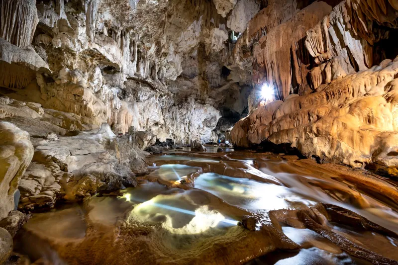
The term "underground river" is evocative but technically specific. Within karst systems, water does not simply percolate uniformly through rock the way it might through sandy soil. Instead, it preferentially follows conduit pathways — enlarged fractures and cave passages through which flow can be surprisingly rapid, sometimes traveling several miles per day during storm events. This conduit behavior distinguishes karst aquifers from porous-media aquifers and makes them simultaneously more productive and more vulnerable.
Dr. Patricia Kambesis, a karst hydrogeologist whose fieldwork has spanned the Interior Low Plateaus of Kentucky and Tennessee, describes the challenge succinctly: "When you're dealing with a conduit system, the rules that govern conventional groundwater modeling simply don't apply. Water can move through a cave passage in hours that would take months to travel through a comparable thickness of sandstone aquifer. That speed is both an asset and a liability."
The asset is yield. Karst springs such as Maramec Spring in Missouri or Wakulla Springs in Florida discharge extraordinary volumes of water — Wakulla alone has measured flows exceeding 400 cubic feet per second following significant rainfall. The liability is contamination vulnerability. Because water moves so quickly through these systems, there is little time for natural filtration. A surface spill near a sinkhole can reach a municipal water supply within days.
Dye Tracing and the Art of Following Water Underground
To map these invisible pathways, researchers rely on a technique that is elegant in its simplicity: dye tracing. A measured quantity of non-toxic fluorescent dye — typically fluorescein or rhodamine WT — is introduced at a surface recharge point, such as a sinkhole or a losing stream, and then detected at downstream springs, wells, or cave passages using activated charcoal samplers or continuous fluorometers.
Over decades, thousands of dye traces have been conducted across American karst regions, and the cumulative data paint a striking picture. In the Mammoth Cave system of Kentucky — the world's longest known cave, with more than 420 surveyed miles — dye traces have demonstrated hydrological connections spanning more than twenty miles, linking agricultural fields on the surface to springs that feed the Green River. The implications for water quality management in that region are profound.
More recently, researchers working within the Edwards Aquifer of central Texas have used dye tracing in combination with high-resolution cave survey data to model recharge zones with unprecedented precision. The Edwards supplies water to San Antonio and surrounding communities — a metropolitan area approaching three million people — and understanding exactly where and how quickly surface water enters the aquifer has become a matter of considerable urgency as the region experiences prolonged drought cycles.
Cave Survey Data as Hydrological Infrastructure
One of the less-publicized contributions of organized speleological research is the accumulation of detailed cave survey maps that serve as foundational data for hydrogeological modeling. Organizations such as the Cave Research Foundation and numerous regional grottos affiliated with the National Speleological Society have invested tens of thousands of volunteer hours producing three-dimensional surveys of cave passages that would otherwise be entirely inaccessible to conventional geological instruments.
These surveys, when integrated with surface topography, geological mapping, and water chemistry data, allow hydrogeologists to construct conceptual models of how karst aquifer systems are structured. Dr. Benjamin Schwartz, director of the Aquifer Science and Technology program at Texas State University, has noted that detailed cave maps from the Barton Springs segment of the Edwards Aquifer provided critical geometric constraints for numerical flow models that simply could not have been derived from borehole data alone.
"The cave is the aquifer made visible," Schwartz has observed. "Every passage a speleologist maps is a data point that tells us something about how water is organized and transmitted at depth."
Climate Volatility and the Pressure on Karst Systems
The urgency behind this research has intensified as climate projections for much of the American Southwest and Southeast suggest longer droughts punctuated by more intense precipitation events. For karst aquifers, this pattern presents a particular challenge. During drought, spring discharge declines and water tables in conduit systems drop, sometimes dramatically. During intense rainfall, the rapid recharge that characterizes karst systems can overwhelm natural storage capacity and transmit contaminants at speed.
In the Ozark Highlands of Missouri and Arkansas, researchers have documented declining base flows at major karst springs over the past several decades, a trend attributed to both increased groundwater withdrawals and shifting precipitation patterns. Springs that historically maintained consistent discharge through dry summers are now showing greater seasonal variability, a signal that the underground reservoirs feeding them are under stress.
For communities whose water systems depend on these springs, the message from speleological and hydrogeological research is clear: the invisible infrastructure beneath their feet requires the same attention to monitoring, protection, and management as any surface reservoir.
Protecting What Cannot Be Seen
Perhaps the most significant contribution that cave science can make to water resource management lies in delineating recharge zones — the surface areas through which water enters karst aquifers. Because contamination introduced at a recharge point can travel rapidly to water supply sources, land use decisions within these zones carry disproportionate consequences.
Speleological research contributes to this effort in multiple ways: through dye traces that establish hydrological connections, through cave surveys that reveal the geometry of conduit networks, and through water chemistry monitoring that tracks the chemical signatures of recharge events. In several states, including Florida and Texas, karst research has directly informed the designation of contributing zones around public water supply springs, providing a legal and regulatory framework for restricting activities that pose contamination risks.
The work is painstaking, often conducted in physically demanding conditions far from public view. Yet the practical stakes could scarcely be higher. As the American West confronts the prospect of a drier future and eastern states grapple with the consequences of aging infrastructure and population growth, the hidden rivers flowing through the nation's limestone bedrock represent a resource whose full value is only beginning to be understood.
The speleologists who descend into these passages — measuring, mapping, sampling, and recording — are not merely satisfying scientific curiosity. They are, in a very real sense, taking inventory of a water supply that millions of Americans depend upon without knowing it exists.