Stone Forecasts: How Speleothem Chemistry Is Becoming a Tool for Predicting Tomorrow's Climate Extremes
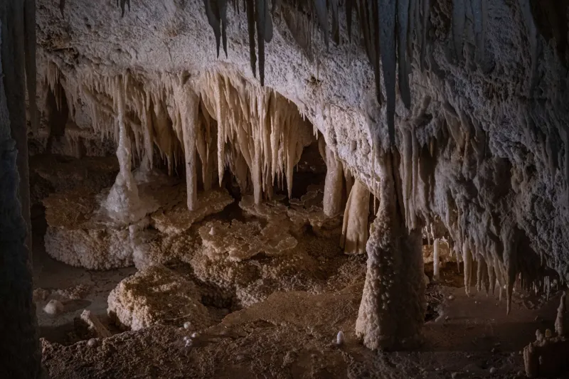
A stalagmite growing in a Tennessee cave does not know it is a climate instrument. It knows only the chemistry of the water dripping onto it—water that has filtered through soil, dissolved trace elements from the overlying rock, and carried a chemical signature shaped by the temperature, humidity, and precipitation patterns of the surface world above. Layer by layer, season by season, that chemistry is recorded in calcite. What scientists are now learning to do is read those records not just as history, but as a template for what may come.
The use of speleothems—the collective term for cave mineral formations including stalactites, stalagmites, and flowstones—as paleoclimate archives is well established. Oxygen isotope ratios, trace element concentrations, and annual growth layer thicknesses have been used for decades to reconstruct temperature and precipitation conditions extending hundreds of thousands of years into the past. What is newer, and considerably more consequential for applied science, is the effort to use those same records as the empirical foundation for forward-looking climate models.
From Archive to Algorithm
The conceptual shift from retrospective analysis to predictive modeling is less radical than it might appear. The underlying logic is straightforward: if a speleothem record faithfully captures the chemical response of a cave system to surface climate variability over, say, 200,000 years, then that record contains within it the full range of natural climate states that the region has experienced. Embedded in that range are analogs for conditions that may recur—or, under anthropogenic forcing, may be amplified or distorted in ways that can be quantified.
Researchers at several American universities have been developing what are sometimes called speleothem-constrained climate models—frameworks that use the statistical relationships between speleothem proxies and instrumental climate records to calibrate and validate broader climate simulations. The approach involves identifying periods in the speleothem record that correspond to known climate events—prolonged droughts, intense monsoon episodes, rapid warming transitions—and using the chemical signatures of those periods as calibration anchors for predictive algorithms.
The Ozark Plateau, the Edwards Plateau of central Texas, and the cave-rich karst regions of the Appalachians have all yielded speleothem records of particular value for this work. Each region faces distinct climate vulnerabilities: the Edwards Plateau sits atop the Edwards Aquifer, the primary water source for several million Texans, and is acutely sensitive to drought variability. The Ozarks drain into river systems critical for agriculture and municipal water supply across multiple states. Understanding how precipitation patterns in these regions have varied in the past—and what chemical signatures accompanied those variations—provides a basis for anticipating how they might shift in the future.
Drought Signatures in Calcite
One of the most practically significant applications of predictive speleothem science concerns drought forecasting. Drought cycles in the continental United States operate on timescales ranging from seasonal to multi-decadal, and their impacts on agriculture, water supply, and wildfire risk are well documented. What has been less clear is the full range of drought severity and duration that American climate systems are capable of producing—a gap that instrumental records, which extend back only about 150 years in most regions, cannot adequately fill.
Speleothem records bridge that gap. In cave systems across the southwestern United States, researchers have identified chemical signatures corresponding to drought episodes far more severe and prolonged than anything in the historical instrumental record. Magnesium-to-calcium ratios, which shift predictably as water residence time in the soil increases during dry periods, have been used to reconstruct drought intensity with considerable precision. Some records from the Great Basin and Colorado Plateau regions document multi-decade megadroughts during the Medieval Climate Anomaly—dry periods so severe that they would, if repeated today, overwhelm current water management infrastructure entirely.
The predictive value of these findings lies not in the claim that such megadroughts are imminent, but in the demonstration that they are within the range of natural climate variability for these regions. Incorporating that information into long-range water resource planning and drought preparedness frameworks is a straightforward application of the science—one that several state agencies in the American West are beginning to take seriously.
Extreme Precipitation and Flood Risk
At the opposite end of the hydrological spectrum, speleothem records are also yielding insights relevant to extreme precipitation events. Flood layers preserved within cave deposits—sediment bands, hiatuses in speleothem growth, and anomalous isotopic excursions—provide evidence of past flood episodes that, in some cases, substantially exceeded anything in the modern record.
In the cave systems of the Ozark Plateau and the Cumberland Plateau of Tennessee and Kentucky, researchers have documented flood signatures corresponding to precipitation events of a magnitude that current engineering standards for flood control infrastructure do not account for. These findings have direct implications for communities in flood-prone karst regions, where sinkholes and losing streams can funnel large volumes of water into drainage systems with little warning.
The connection between speleothem chemistry and flood risk is not always direct—cave formations are not flood gauges in any simple sense—but the integration of multiple proxies within a single record can yield a composite picture of hydrological extremes that complements and extends the information available from surface-based records. When speleothem evidence of past flood events aligns with independent sedimentological data from cave deposits, the resulting reconstruction carries considerable statistical weight.
The Calibration Challenge
The most significant technical obstacle in speleothem-based climate forecasting is calibration: establishing, with sufficient rigor, the quantitative relationship between specific chemical signatures in the deposit and specific surface climate variables. This requires both high-quality modern monitoring data from cave systems and robust statistical methods for translating proxy signals into climate variables.
Several ongoing monitoring programs at American cave systems—including long-term drip water chemistry studies at sites in Missouri, Virginia, and New Mexico—are generating the calibration datasets that predictive models require. These programs instrument caves with continuous sensors measuring temperature, humidity, drip rates, and water chemistry, correlating those measurements with surface weather station data over periods of years to decades. The resulting calibration records are gradually improving the precision with which past speleothem chemistry can be translated into quantitative climate estimates.
Implications for Policy and Preparedness
The practical applications of this research extend well beyond academic climate science. Federal and state agencies responsible for water resource management, flood control infrastructure, and drought contingency planning are increasingly attentive to paleoclimate data as a supplement to the relatively short instrumental record. The recognition that the past century of American climate history may not represent the full range of variability that the climate system is capable of producing has significant implications for infrastructure design, insurance modeling, and emergency management planning.
Speleothem science, once confined largely to academic journals and cave research conferences, is finding new audiences in policy circles. The cave systems of the United States, it turns out, contain not only a record of the world that was, but a set of probabilistic constraints on the world that may be. Reading that record carefully—and translating it into actionable guidance—is among the more consequential scientific projects currently underway in American geoscience.